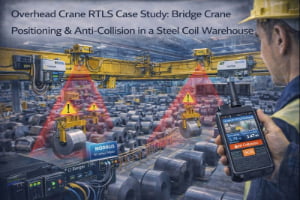
Overhead cranes are the backbone of heavy manufacturing and steel handling. They move ladles, coils, plates, molds and large assemblies over workers, production lines and storage areas. In many plants, several cranes share the same runway or cross above each other. Operators rely on line-of-sight, horn signals and simple end-stop switches to avoid collisions.
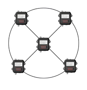
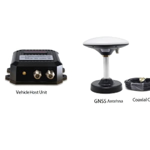
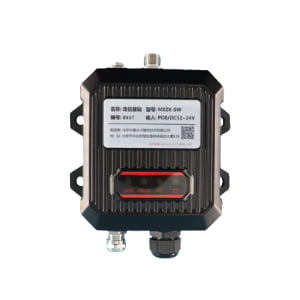
The Overhead Crane RTLS & Anti-Collision solution adds a precise positioning and distance layer to crane operations. UWB ranging devices and collision units mounted on each crane continuously measure distance to other cranes, end stops and defined obstacles. At the same time, optional anchors and RTLS infrastructure provide continuous position tracking along the runway and across the bay, so you always know where each crane is and which zones are occupied.
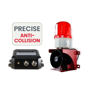
Depending on the risk level, the system can provide step-by-step warnings—first visual and audible alerts to operators, then automatic slow-down, and finally enforced stops via relays into the crane’s safety chain, according to standards and your internal rules. All movements and near-miss events can be recorded, giving maintenance and HSE teams objective data for improving layouts, procedures and training.