Skip to content
Industrial UWB RTLS for Real-Time Visibility
Menu

CFJZ — GNSS Differential Reference Base Station

A high-precision GNSS/Beidou differential reference station that provides centimeter-level RTK corrections and sub-meter static accuracy. Supports RTCM differential data output, 4G/WiFi backhaul, UWB optional transmission, and fully integrates with positioning platforms for mining, ports, factories, and outdoor infrastructure.

SKU: CFJZ001
A white, dome-shaped ceiling-mounted device with a flat metallic base and visible fasteners, shown against a plain white background.

Transmission & Network

Primary Transmission
Ethernet (RJ45)
Network Topology
Wired

At-a-Glance

Positioning Technologies
GNSS/Beidou
Communications & Interfaces
4G, 5G, Wi‑Fi 2.4/5 GHz
Hot-swappable Battery
No
Ingress Protection
IP67
Operating Temperature
–40°C ~ +80°C
Dimensions
φ218 × 115 mm
Weight
<1.2 kg
Accuracy: 2cm
Range: 100m
Temp: -40~80°C
Weight: 1200g

Description

Overview

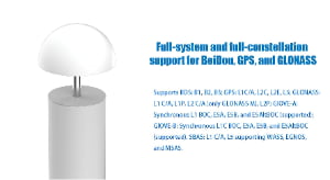
The CFJZ GNSS/Beidou Differential Reference Station is a high-performance GNSS correction base station designed to improve mobile positioning accuracy from meter-level to centimeter-level RTK and achieve sub-meter static accuracy.
It continuously tracks satellite signals, compares them with the known fixed coordinates, calculates satellite errors, and broadcasts correction data to mobile positioning terminals.

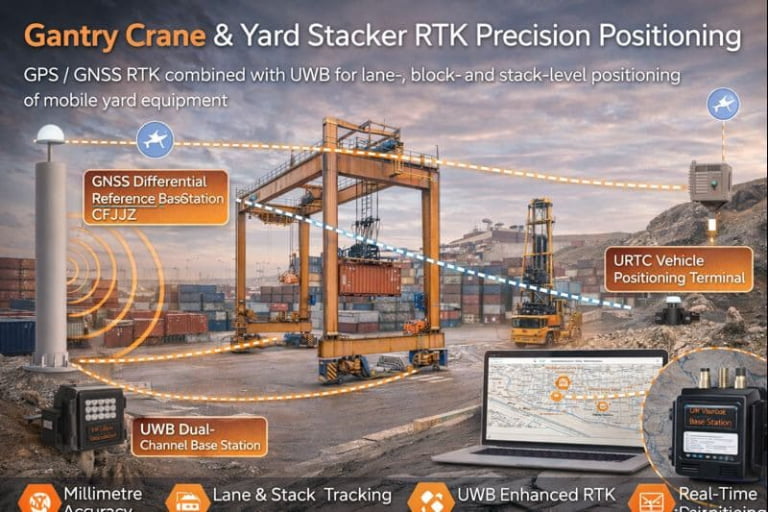
This reference station is widely used in mines, ports, construction sites, industrial parks, petrochemical areas, municipal management, intelligent transportation, and other outdoor fixed-point positioning environments.

A white GNSS antenna with text indicating support for BeiDou, GPS, GLONASS, and various frequency bands and satellite-based augmentation systems.


Key Features

A white dome-shaped device is shown from below, with labeled ports: Indicator Light Area, Rating Plate, Mounting Port, DC Power Port, and RJ45 Network Port.

1. Centimeter-Level Accuracy

  • RTK dynamic accuracy: 2 cm

  • Static accuracy:

    • Horizontal: 2.5mm + 0.5ppm

    • Vertical: 5.0mm + 0.5ppm

2. Multi-Format Differential Output

Supports mainstream differential formats:

  • RTCM 2.x

  • RTCM 3.x

  • Ntrip

Compatible with all major GNSS receivers and positioning terminals.

3. Multi-Mode Communication

  • 4G full-netcom backhaul

  • Optional 5G/WiFi

  • Supports TCP, UDP, HTTP network protocols

  • Optional UWB differential broadcast (>100m) for local positioning networks

White dome-shaped device with dimensions labeled: 115mm in height and 218mm in width. Text reads "Device Dimensions" in blue.

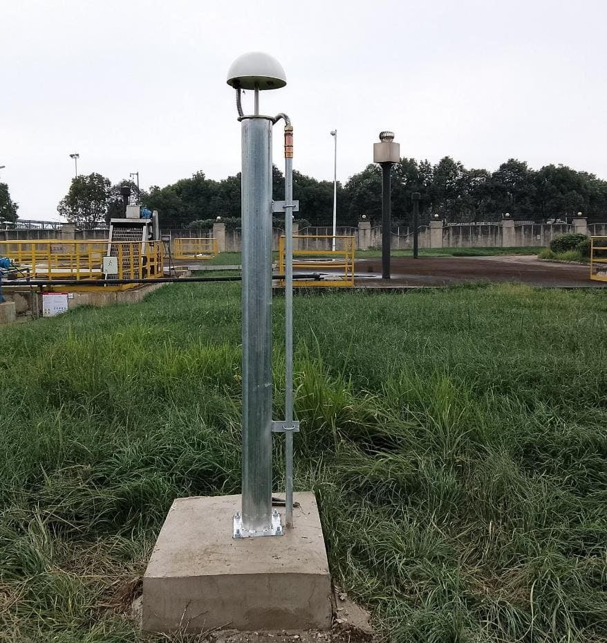
4. Industrial-Grade Outdoor Design

  • Fully sealed fiberglass + aluminum alloy housing

  • IP67 waterproof/dustproof

  • Works in harsh environments: –40°C to +80°C

  • Suitable for long-term rooftop / pole installation

5. High Stability & Reliability

  • Initialization reliability > 99.9%

  • LED status lights for easy status monitoring

  • Stable 24/7 continuous operation


A white dome-shaped device is shown from below, with labeled ports: Indicator Light Area, Rating Plate, Mounting Port, DC Power Port, and RJ45 Network Port.


System Architecture

Diagram showing BeiDou satellites communicating with a differential reference station, which connects via 4G to a server or cloud server through an RJ45 network port.

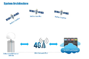
① Beidou/GNSS Satellite → Base Station → Mobile Positioning Terminals

  1. The base station receives high-precision satellite signals.

  2. Compares with preset known coordinates.

  3. Calculates satellite clock/orbit atmospheric errors.

  4. Broadcasts correction data via:

    • 4G/5G/WiFi network

    • RJ45 wired network

    • UWB short-distance broadcast

② Mobile terminals using correction data

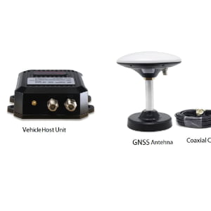
  • Vehicle positioning terminals

  • Personnel positioning tags

  • Smart helmets

  • Portable RTK units

  • UWB hybrid positioning terminals

All can receive differential data to achieve centimeter-level positioning.
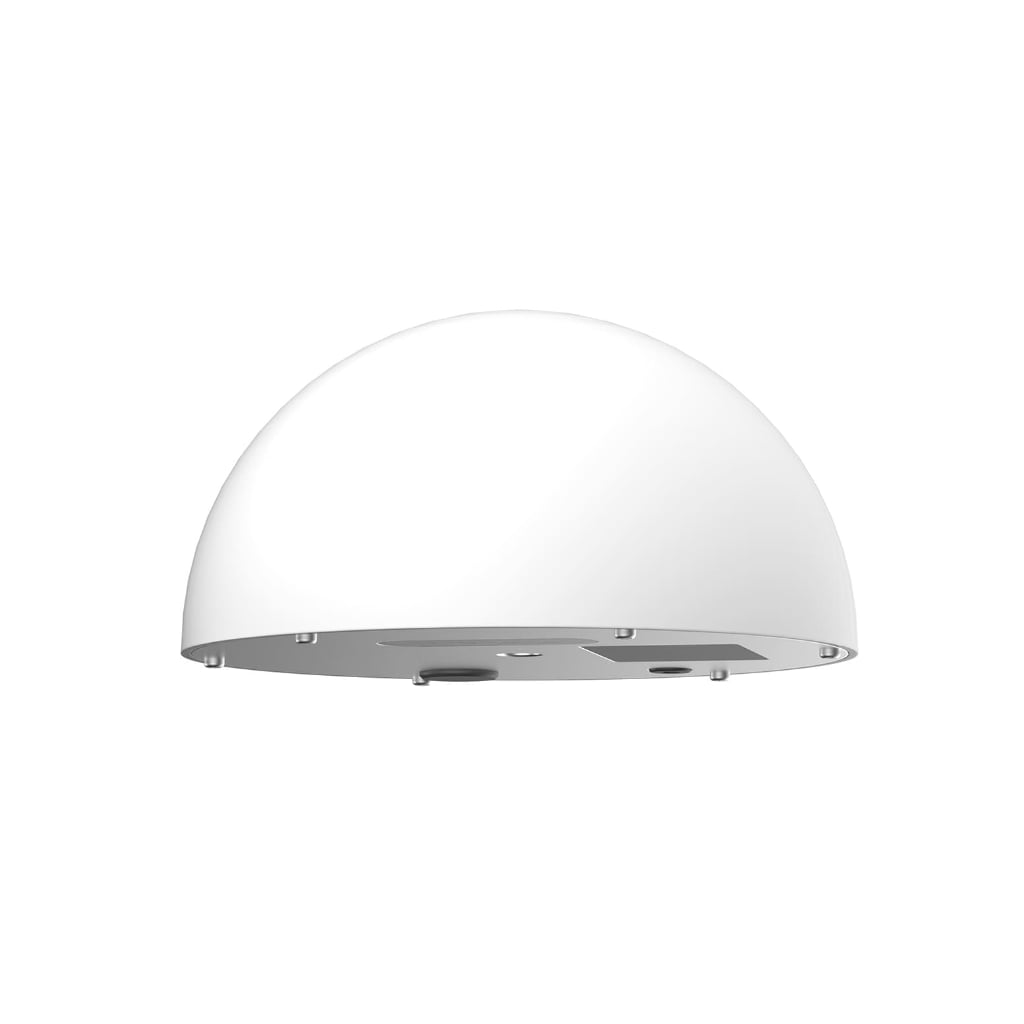
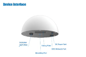

Device Structure

  • LED indicator area

  • DC input port

  • RJ45 network port

  • Mounting holes

  • Reinforced waterproof shell (fiberglass + metal)

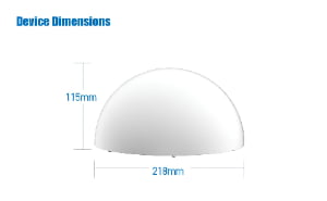
Shell size: φ218 × 115 mm
Weight: <1.2 kg


Application Scenarios

Tall cylindrical sensor device on the left; on the right, blue text lists application areas including mine, bridge, and water conservancy monitoring, hydropower, mechanical control, and more.

  • Mining open-pit positioning

  • Petrochemical plant management

  • Port vehicle dispatching

  • Industrial park RTK positioning

  • Tunnel construction

  • Smart manufacturing zones

  • Municipal engineering

  • Outdoor RTK fixed infrastructure


Specifications

Static AccuracyHorizontal: 2.5mm + 0.5ppm; Vertical: 5.0mm + 0.5ppm
RTK Accuracy2 cm
Initialization Reliability>99.9%
Output Rate1–10 Hz
Differential FormatRTCM 2.x, RTCM 3.x, Ntrip
Rated InputDC 12 V
LED Indicators4 pcs
Communication InterfaceRJ45
Transmission Mode4G full-netcom (optional 5G/WiFi)
UWB Transmission>100 m
Housing MaterialFiberglass + Aluminum Alloy
Operating Temperature–40°C ~ +80°C
Network ProtocolsTCP, UDP, HTTP
Device Sizeφ218 × 115 mm
Weight<1.2 kg
Humidity0%–90% non-condensing
Protection GradeIP67

Values are typical unless stated otherwise.


Installation

A metal pole with a dome-shaped device on top is mounted on a concrete base in a grassy outdoor area with industrial structures in the background.

Compatible / Accessories


🌍 Industries where this device is deployed

Related Technical Resources

FAQs

Procurement (Device & Data Layer)

Shortlisting devices? Get an RFQ-ready BOM path.

Move from product selection to an actionable RFQ: scope boundaries, terms, lead time, and deliverables.

Ready to Deploy RTLS?

Share your site layout and accuracy needs--we'll suggest a practical setup.

Contact Us